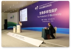
Dina Matyukhina, a research associate at the Leopard Land National Park, has made a presentation at the International Environment Forum in the Changbaishan Nature Reserve in China on using state-of-the-art methods to develop conservation models for the Amur tiger.
According to Ms Matyukhina, the simulation method implies analysing correlations between the locations where the predator’s presence is detected (for example, places where tiger tracks are detected) and the characteristics of the place where it occurred (for example, the environment). These methods rely on the analysis of space-related data (geographic information system layers) and statistical data.
The processing of this data allows for the creation of spatial distribution maps taking into account animals’ environmental needs and the probability of encountering the tiger in specific locations. This method is widely used in many fields of biology and can serve as an instrument for planning new protected areas and conservation corridors between isolated animal groups.
Furthermore, Ms Matyukhina said that this method could be used to study the competitive relationship between tigers and leopards to understand where their interests overlap. For example, accumulating data on locations where leopards and the Amur tiger can be spotted frequently (depending on their needs) enables to better understand whether these locations overlap and in what way – the type of habitat, the availability of prey, the remoteness of roads and communities, the elevation above sea level, etc. The data will then be interpreted to provide scientists with the possibility to decide how to minimise competition between predator species.


 ABOUT THE PROGRAMME
 AMUR TIGER: LIFE, BEHAVIOUR AND MORE
 AMUR TIGER RESEARCH: A HISTORY
 VLADIMIR PUTIN'S VISIT
 NEWS
NEWS
 MULTIMEDIA