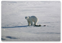
Polar mammals are suffering from the meltdown of the Arctic ice cap and are closely monitored by scientists, who realise only too well that the dwindling food base and reproduction decline put the very survival of polar animal species at risk.
Satellite-aided tracking is an effective new method of surveying Arctic wildlife. Fellows of Russia’s Severtsov Institute of Ecology and Evolution use images by the GeoEye-1 satellite to see how the Arctic’s most charismatic mammal species, the polar bear, is coping with its changing habitat. They have found the right settings to identify bears in photos taken from the outer space.
“Researchers are interested in the polar bear’s daily and seasonal migration patterns, in its nutrition and food resources, in the spread and population change of its prey, in natural and man-made factors which influence the species’ reproduction and survival, and in the genetic identification of individual animals,” Nikita Platonov, senior fellow at the Institute of Ecology and Evolution, said in a STRF.ru interview. “In order to gather data, we also monitor the animals from the sea and the air and conduct surveys among people who live and work in the North. Specialists tranquilized and examined more than forty polar bears in the period between 2010 and 2012. Ten females were fitted with satellite telemetry collars to follow their range. Traditional surveying methods are money-consuming as expeditions cost a lot to mount, and they also put the life and health of human participants at risk. Satellite tracking, meanwhile, is absolutely safe, for people and animals alike.”
The main difficulty in tracking animals from the outer space is that this method has not yet been used long enough to guarantee against errors in identification, so the satellite may mistake any similarly shaped object for a bear, such as a rock, an ice floe, or even a barrel.
Unlike a satellite, a human observer on board a vessel or plane often has the chance to watch an object for a while and from various viewpoints, making misidentification less likely.
Researchers surveying the Arctic’s polar bear need to develop a remote probing method and to learn how to derive necessary information from the images received.
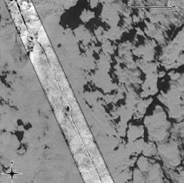
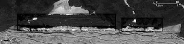
To address this problem, a photographic image of the tiny Herald Island and the surrounding waters has been analysed. Part of the Wrangel Island nature reserve, Herald remains uninhabited, so observations here are not impeded by any human activity. The photo was taken in June 2009, on a calm, sunny day. There is a good chance of spotting polar bears in the Arctic in June, as well as walruses basking on shores and beaches, and seals on the ice, along with the breathing holes they make in it.
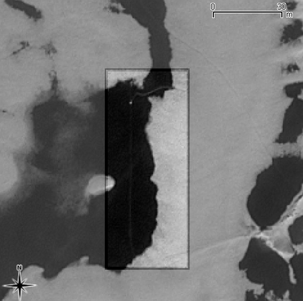
Polar bears move on land and sea ice much more actively than other marine mammals, which is why researchers should pay special attention to their paw prints. For the first time ever, an analysis of polar bear paw prints has been made using ultra high-definition satellite images. In a photo, a chain of freshly made paw prints looks like a dark strip, but its constant width is what makes it different from a crack in pack ice. If old and covered up with snow, a paw print viewed from above looks lighter in tone that the surrounding ice and snow.
Researchers say that raising satellite cameras’ definition above 0.2m will make it possible to identify individual and family prints as well as tracks. If the snow is deep, cubs follow in their mother’s steps instead of making their own trail.
In analysing images of the coastal zone, researchers pay special attention to river estuaries. Estuaries are the starting point of a bear’s journey inland for hibernation, and it is here that females come with their cubs as they are heading for pack ice.
The area being analysed is known to be well heated by the sun, so there can be no pack ice here in June. Hence the white spots against the dark background must be bears.
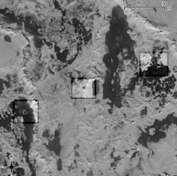
Against the ice, polar bears are much harder to make out; they can be easily mistaken for floes, as can fin-footed mammals. Researchers have to take into account all the diversity of pack ice’s shapes and varieties. Fin-footed mammals are hard to discern when on ice. In wintertime walruses look darker than snow. But when the snow darkens in spring, a walrus will stand out as a spot of lighter colour. And if a walrus has just got out of the water, its wet fur will reflect more light than the surrounding snow does. In short, there are a lot of things to be factored in when analysing satellite images.
Researchers believe that autumn is the best period for satellite observation. During this season, animals are easy to spot against fresh snow. It becomes too dark in winter, whereas in spring, ice melts down, making the surface inhomogeneous. Polar bears are easy to mistake for an ice floe of the same size. Also, they may be hiding in the shade.
Analysing satellite images is a meticulous job; to make sure all the details are properly studied, an image has to be divided into several thousand parts. And it is preferable that several independent experts take a look.
Scientists believe that the future belongs to this kind of observation method where no stress is put on the wildlife, nor on the humans surveying it, and that the surveys will grow more accurate with time and practice.
Compiled by Natalia Reznik
Sourced from: Nikita Platonov, Ilya Mordvintsev, Vyacheslav Rozhnov, “On the Possibility of Using High-Definition Satellite Images for Spotting Marine Mammals.”


 ABOUT THE PROGRAMME
 POLAR BEAR RESEARCH: A HISTORY
 POLAR BEAR: LIFE, BEHAVIOUR AND MORE
 VLADIMIR PUTIN'S VISIT
 NEWS
NEWS
 MULTIMEDIA